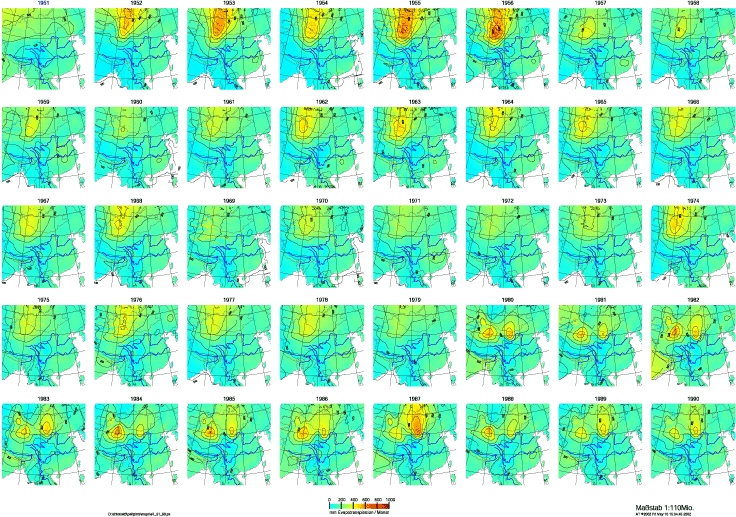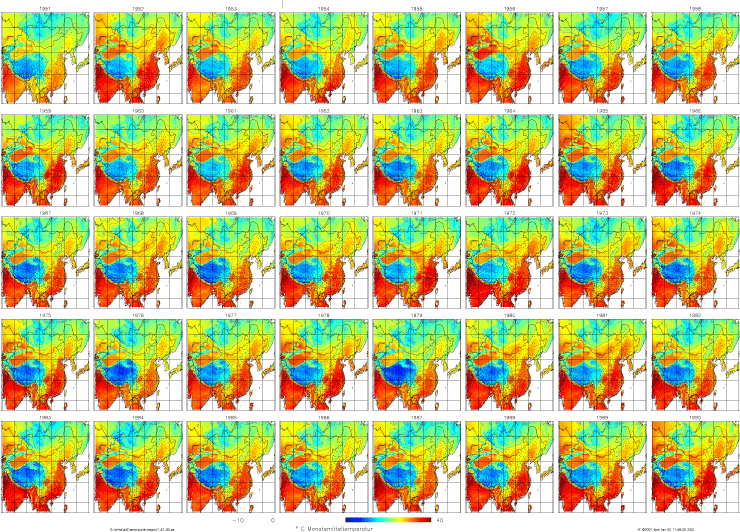
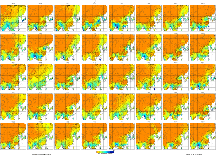
REGEOTOP was used to calculate monthly climate maps of temperature, precipitation and potential evapotranspiration at 0.25° resolution.
These maps show the large temporal and spatial climatic differences that occur over the East Asian continent due to its large areal and altitudinal extent and the influence of the Asian monsoon system.
For the first time high-resolution PET monthly time series are available for the East Asian continent.
July temperatures 1951 - 1990
July precipitation 1951 - 1990
July PET 1951 - 1990