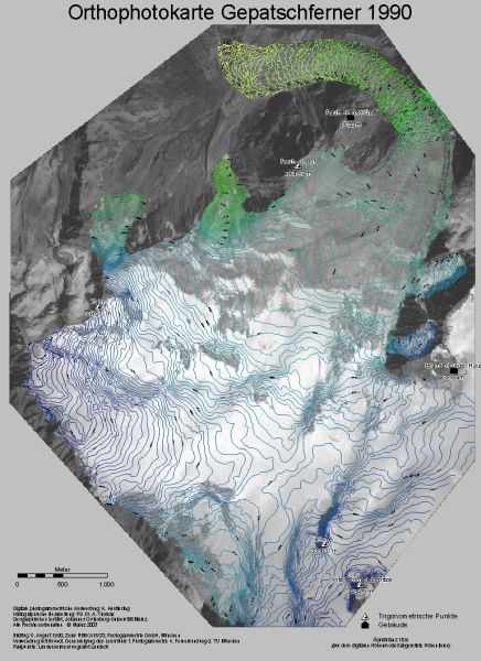
An essential tool for further studies
is the orthophoto map of Gepatschferner. The map is based on a
high-altitude aerial photographic survey commissioned by the Bavarian
Commission for Glaciology of the Bavarian Academy of Sciences.
Dipl.-Geogr. Andreas Keutterling used digital photogrammetric
techniques to produce this map for his diploma thesis.
We were able to measure directly glacier mass changes by comparing the
photogrammetric digital elevation model to a digital elevation model
derived from a digitized map of the German Alpine club DAV (sheet 30/2
Ötztaler Alpen, Weißkugel, scale 1:25000, survey year 1971).
In addition we use the map as a base map for future surveys.
The map shown here is a 1:25000 scale version of the original 1:10000
scale map that was published in the journal Zeitschrift für
Gletscherkunde und Glazialgeologie (ZGG 39, S. 59-64, 2003/2004).