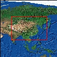
Region East Asia
Influence of Climatic Change on water balances and agricultural production
in China
German title: "Climatic Change" und sein Einfluß auf Wasserbilanzen
und Erträge in China
Introduction
The influence of a climatic change possibly caused by human influences
on agricultural ecosystems is one of the most pervasive topics of recent
research (IPCC 2001). A decrease of agricultural production in China, the
country with the world largest population, could have far reaching influences
on the global food supply (Harris 1996). Until now (1999) analysis of the
carrying capacity of Chinese agriculture relied on unsuffficient climatic
data and arrived at vastly differing conclusions. Spatial climatic data
sets necessary for such an analysis are are also a prerequisite for quantitative
analysis of all forms of research on changes in natural or antropogenic
ecoysystems and for the verification of the results of Global Climate Modells
(GCMs). Available data for China are unsuitable for detailed regional analysis
as they have either a too low resolution, are the results of relatively
unreliable GCM runs or have been derived from climate data bases with a
small station number of stations or by unreliable interpolation methods.
Mission
This study aims at deriving monthly climatic data fields for temperature,
precipitation and potential Penman-Monteith evapotranspiration (PET) with
a spatial resolution of at least 0.25° for the period 1951 to 1990.
The research area encompasses the PR China (including Tibet) and surrounding
countries from 15° N to 55° N and from 65° E to 140° E.
Objective regionalisation of climate with particular reference to the influence
of topography is provided by REGEOTOP, a modified version of AURELHY (Benichou
und Lebreton 1987). REGEOTOP integrates methods from the sectors of GIS,
remote sensing, multivariate statistics and geostatistics to modell climatic
dat fields that take both topographic and continental-scale influences
into account.
Methodology and Data
The study is mainly based on a collection of Chinese climate data collected
during field work that to a considerable larger extent than previous studies
incorporates data from Western China and Tibet. Data from international
sources, namely CDIAC and GHCN v2 were added were necessary. From initially
more than 2000 station data sets 501 and 420 stations for precipitation
and temperature in China and 261 and 371 stations outside of China, resp.
were selected after thorough preanalysis. PET was estimated from daily
data for 196 stations in China. After statistisal tests and controls of
plausibility to enshure homogenity of the data 486, 364 and 196 stations
for precipitation, temperature and PET, resp. in China and 186 and 167
stations for precipitation and temperature,resp. outside of Chinas were
retained for final analysis.
A principal component analysis (PCA) of a digital elevation model (DEM)
is used to quantify the influence of the topography on the spatial distribution
of climate variables. The resolution of the DEM (GTOPO30) was resampled
to 300" (app. 10 km). At least 90% of the variance of the DEM is explained
by 10 to 18 proncipal components. The principal components are interpreted
as "basic topographies" that describe topography as a linear weighted combination
of simple morphological forms such as basins, domes, slopes and other,
more complicated forms. A linear stepwise multiple regression is used to
relate position (latitude, longitude and altitude) and topography surrounding
a climate station (principal components) to the observed climate variables
For each grid point of the DEM a value is estimated from the regression
equations and the residuals are calculated from grid points that contain
a climate station. Geostatistical analysis (variography) with manually
selected variogram parameters is used to interpolate the residiuals with
simple kriging. By adding the residual fields to the regression fields
the final 1440 monthly data surfaces (3 climate variables x 40 months x
40 years) are obtained. Because of computational restraints the resolution
of the data fields was restricted to 0.25°.
Results
A comparison between observed vs. calculated values (restricted to the
area of the PR China) yield monthly correlation coefficients of 0.628 -
0.814, 0.943 - 0.990 and 0.892 - 0.959 and rms values of 17.2 - 83.2 mm,
1.5 - 1.8° C and 5.7 - 24.2 mm for precipation, temperature and PET,
resp. The highest residuals are observed in mountain areas, where large
differences between the actual topgraphy and the smoothed topography represented
by the DEM occur.
Based on the monthly climate data fields maps of several climatic indices
were constructed. These data sets allow a more thorough analysis of regional
climate than maps based on traditional isolines by portraying even small
climatic differences that occur due to exposition and seasonally varying
wind directions of the monsoons. For the first time a spatially and temporally
detailed distribution of Penman-Monteith evapotranspiration estimates over
China is possible. They show pronounced spatial differences with annual
evapotranspiration exceeding 2000 mm in the deserts of Western China and
a regional minimum of app. 600 mm in the Basin of Sichuan. Even though
the influence of monsoonal airmasses is clearly visible in the seasonal
variation of PET no clear correlation can be found to the spatial distribution
of either precipitation or temperature.
Studies on the interannual variation (based on deciles and decile differences)
underline that the lowest relative precipitation variability occurs in
the region with the highest precipitation averages (South China). The highest
interannual variation of PET is observed in the desert areas. Interannual
variations of PET of similar magnitude are proposed for the high mountain
areas where no observational data exists up to now to verify the model
result. The highest interannual variation of temperature is found on the
Tibetan Plateau which at the same time experienced the largest downward
trend of winter temperatures in the study area. Coupled with significant
summer precipitation reductions during the last decades the Tibetan Plateau
is undoubtly the region strongest hit by the effects of climatic change
in the study area.
Applications
As an example for possible applications of spatially distributed climatic
data sets the temporal variability of thermally defined growing regions
were investigated. In addition the agricultural water balance using FAO
AEZ methodology (Doorenbos und Kassam 1986) was modelled. Monthly trends
of averages and interannual variability were used to describe possible
scenarios of climatic conditions in the years 2010 and 2030. Based on these
data significantly smaller changes in the position and the extent of growing
seasons were found than anticipated from GCM results (Markham 1992).
Resumee
The study has shown that the regionalisation method developed in this study
is capable of reliably reproducing both large and small scale climatic
features even for a continental-scale region with considerable altitude
differences and different climatic zones. However, segmenting the study
area in smaller, climatically homogenous regions was not feasible due to
the low station density resulting in samples too small for statistical
significant regression solutions within the individual regions. Modelling
the precipitation distribution of the Southwest China mountain region alone
achieved far better results than the comparable sub-set from the solution
for the whole study area. Further improvements might be envisaged by working
with anomaly time series calculated against long-term averages to integrate
the vast number of stations for which only long-term means are available.
Increasing DEM resolution to better than the currently available resolution
of 1 km is only limited by available processing facilities but no by methodological
constraints.
Future research
My investigations on climate variability over East Asia have shown that
the Tibetan Plateau in particular has been influenced to a considerable
extent by climatic changes during the recent decades. A cooperation with
colleagues from the "Institute of
Geographic Sciences and Natural Resources Research " of the Chinesische
Academy of Sciences has resulted in the project Geoinformatic
research on effects of climate and land cover change on the agriculture
of the Qinghai-Tibet Plateau which aims at detecting and analysing
changes in the environment of Tibet and to quantify their effects on agricultural
production and forestry. To this end the climate station data base has
been enlarged by more than 200 station from the Southwest China mountain
region and Tibet. Use of the high-resolution DEM of the "Shuttle Radar
Topography Mission" has to be postponed due to delays in data processing
by NASA and DLR. Further research is however of vital importance due to
the role of the Tibetan Plateau in the generation of the Asian monsoon
system and consequently the climate of Asia itself. The successfull regionalisation
of climate data with the methodology shown here is a important step in
this direction.
publications:
Submitted to: International Journal of Climatology
REGEOTOP: New climatic data fields for East Asia based on localized relief information and geostatistical methods
Mit: Herzfeld, U.
PREPRINT!
2002 Integration von Methoden der Geoinformatik für die
Klimaforschung: Relieforientierte Regionalisierung von Klimadaten Ostasiens.
Integration of geoinformatical methods for climate
research: relief-based regionalisation of climatic data of East Asia
Geo-Informations-Systeme 12/2001, 16 - 21. (in German with English
abstract) abstract
2000 Climatic changes in yield index and soil water deficit trends
in China.
Agricultural and Forest Meteorology 102, 71 - 81. abstract
2000 Spatial analysis of Penman-Monteith evapotranspiration trends
over China.
International Journal of Climatology 20, (4), 381 - 396.
abstract
1999 Räumliche Aspekte der potentiellen Evapotranspiration
in China.
Spatial distribution of potential evapotranspiration over China
Petermanns Geographische Mitteilungen 143, (5+6), 349 - 362.
(in German with English abstract)
Project financed by: DFG (German Research Council)
Duration: 1999 - 2001